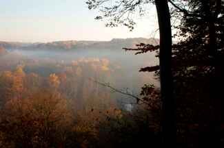
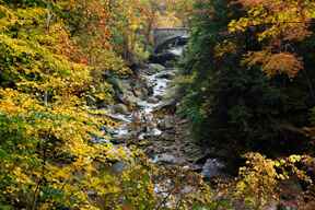
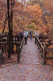
In autumn breathtaking fall colors abound throughout Cleveland Metroparks. Take advantage of a variety of opportunities to view the fall colors from a naturalist-led walk, to a self-guided hike along one of the Park District’s many trails, to a drive along tree-lined parkways.
The changing colors begin in August with the leaves of the tupelo trees changing to yellow and red. Sassafras trees follow suit in September. The peak of the splendid reds, golds, oranges and yellows of autumn occurs in Cleveland Metroparks in mid-October.
One of the best reasons to visit Cleveland Metroparks is the variety of scenery. The river valleys, upland forests and meadows change throughout the seasons – and are especially beautiful in autumn. In almost every reservation there are overlooks and other areas that feature these scenic, spectacular autumn vistas.
Self-guided driving tours:
- Valley Parkway from Scenic Park in Lakewood to Brecksville Reservation.
- Chagrin River Road between North and South Chagrin reservations
- Hawthorn Parkway between South Chagrin and Bedford reservations
Acacia Reservation
Splashes of color are everywhere is this small, open reservation. Fall color isn’t just for the trees as the grasses also turn gold and tan.
Directions: From I-271
Take the Brainard Road/Cedar Road. exit. Follow signs to Cedar Road. Continue west on Cedar Road to Acacia Reservation on the right.
Bedford Reservation
Tinker’s Creek Gorge Scenic Overlook & Little Overlook
Tinker’s Creek Gorge, a national natural landmark, offers a spectacular vista throughout the changing seasons. The Little Overlook, located a quarter-mile west of Egbert Picnic Area, offers another view of the beautiful Tinker’s Creek Gorge.

Directions: From I-271
Take the Broadway Avenue exit. Follow Broadway (north) to the Union Street intersection. Take Union to Egbert Road – turn left. Egbert Road to Gorge Parkway – turn right. The trail is located east of the intersection of Overlook Lane and Gorge Parkway.
Brecksville Reservation
Chippewa Creek Gorge Scenic Overlook
Looking down and over the tops of the trees you are rewarded with a stunning view of the greens of the hemlocks providing the perfect contrast to the dramatic yellows, oranges and reds of the deciduous trees. Chippewa Creek Gorge is worth the short walk in any season.

Directions: From I-77
Take Route 82 east (Brecksville) exit. Cross through the intersection of Routes 82 and 21. Follow Route 82 to Chippewa Creek Drive, turn right. The trail is located on Chippewa Creek Drive, just west of the Harriet Keeler Picnic Area.
Garfield Park Reservation
Mill Creek Falls Overlook
This 1.18 mile trail winds throughout Garfield Park Reservation and meanders along side of Mill Creek. This hilly excursion is perfect for those adventurous types wanting to unmask the treasures of the historic1888 Brilla House and Mill Creek Falls overlook.
Directions: From I-480
Take the Broadway Avenue/Garfield Heights exit, turn right onto Broadway. Follow Broadway to Turney Road. Turn right on Turney. Go abut one mile to traffic light at Warner Road. Veer left into Mill Creek Falls.
Hinckley Reservation
Hinckley Lake Overlooks
A number of locations on East and West Drives offer beautiful panoramic views of the reds and yellows of maple and tulip trees mirrored in the lake. Early risers may be rewarded with the spectacular sight of fall colors and early morning mist rolling over the lake. The best views are on West Drive looking down at the east branch of the Rocky River, a quarter-mile west of State Road, and on East Drive, a quarter-mile south of Bellus Road.
Directions: From I-71
Take Route 303 east exit. Follow Route 303 to Hinckley Hills Road (Route 606), turn right. Follow to Bellus Road and turn left. Follow to either West or East drives, and turn right.
Mill Stream Run Reservation
Baldwin and Wallace Lakes
No need to get out of your car to see the beautiful oranges and reds of the floodplain trees reflecting off the lakes.
Directions: From I-71
Take Bagley Road exit and go west on Bagley Road. Continue past Front Street and Rocky River Drive. Mill Stream Reservation entrance is on the left.
North Chagrin Reservation
A.B. Williams Beech-Maple Forest Overlook Trail
A short 0.4 mile walk will take you through a brilliant yellowish-orange and red beech-maple forest to a small overlook where you’ll get an overhead view of the Chagrin River through the trees.
Directions: From I-271
Take the Wilson Mills Road exit east to SOM Center Road/Route 91 and turn left. Follow Route 91 and turn right on Sunset Lane. Turn right on Buttermilk Falls Parkway. The trail is located east of the Forest Picnic Area. Follow the signs to the overlook shelter.
Hickory Fox Loop Trail
Follow the edge of a beautiful ravine into a hardwood forest for a spectacular view of the deep ravine skirted with dramatic fall color.
Directions: From I-271
Take the Wilson Mills Road exit east to SOM Center Road/Route 91 and turn left. Follow Route 91 and turn right on Sunset Lane. Turn right on Buttermilk Falls Parkway. Park at Buttermilk Falls and cross parkway to trailhead for this 1.6 mile loop trail.
Squire's Castle
F.B. Squire's 1890s "castle" provides the perfect backdrop for amazing fall colors.
Directions: From I-271
Take the Wilson Mills Road exit east to Chagrin River Road. Turn left on River Road.
Rocky River Reservation
Berea Falls Scenic Overlook
Surround yourself with breathtaking color. A short walk to this large deck rewards you with an amazing vista of yellow and orange trees high above the Rocky River. The view is especially good after a major rain when the Rocky River is running high.

Directions: From I-71
Take Bagley Road exit and go west on Bagley Road. Continue past Front Street and Rocky River Drive. Turn right on Barrett Road and right on Valley Parkway. The overlook is on the right.
Fort Hill
After climbing the 135 steps to the top of Fort Hill you are rewarded with a breathtaking vista of the East and West branch confluence of the Rocky River.
Directions: From I-480E
Take the Grayton Road exit. Turn left on Grayton Road. to Puritas Road. Turn left on Puritas Road, then left on Valley Parkway. Park in Rocky River Nature Center parking lot. The trail starts behind the nature center.
South Chagrin Reservation
Quarry Rock Overlook
This short 0.4 mile loop trail winds through second growth woods near the site of a quarry providing a spectacular view down into the Chagrin River including the Henry Church Jr. Rock area.
Directions: From I-271
Take the Chagrin Boulevard. exit east. At Lander Circle bear right and take Route 422 east. Follow 422 to Route 91/SOM Center Road then turn right. Follow Route 91 to Cannon Road then turn left on Solon Road. Turn right to Quarry Rock Picnic Area.
